
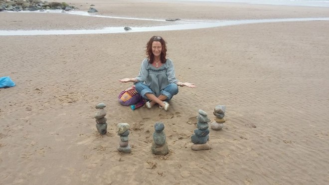
Toot and Ploot, my bluetits being very active
The Ilkley Moor Petroglyph Walk – 8 Interesting Stones in one short route
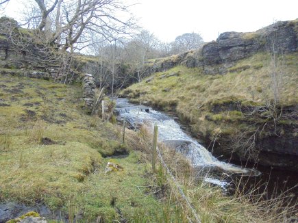
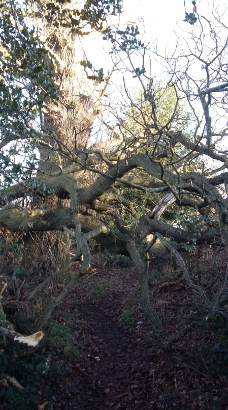
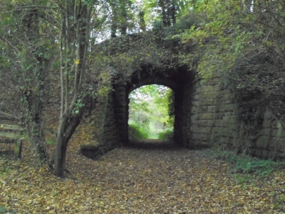
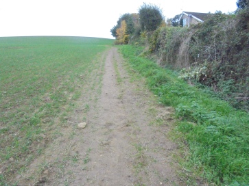
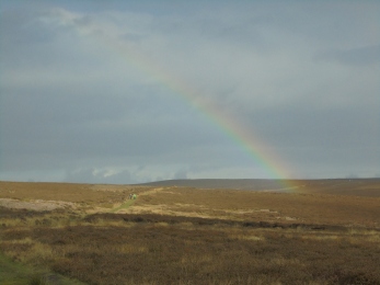
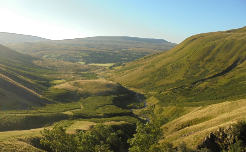
Ilkley Moor is home to an estimated 300-400 carved stones, the majority of which are home to numerous carvings of cup and rings and petroglyphs, over the years some of the stones have been lost to quarrying whilst others are still waiting to be discovered, as they lay, unearthed and covered in moss and soil, as they have done for thousands of years. Surviving examples of rock art in the British Isles are believed to represent only a small sample of that which had been produced in the Neolithic and Bronze Ages. Many examples of petroglyphs would have eroded away, thereby being lost to contemporary scholarship. In other examples, images might have been painted onto rock, or marked onto less permanent surfaces, such as wood, livestock or the human body, thereby also failing to survive into the present.This walk I’ve devised is both short and interesting, it only covers a distance between 2 and 3 miles on roughly the western side of the moor. It’s certainly not a difficult walk and there are easily followed footpaths between the carved stones, the terrain is outstanding and, other than the stones, it’s full of surprises, I’ve seen wild deer, dead sheep and even a brand new shovel and pick axe which seemed to have been abandoned.
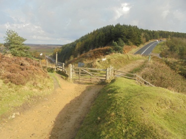
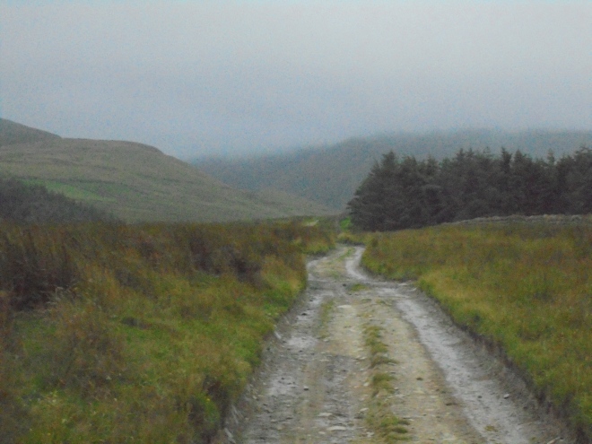
The route is a horseshoe which starts and finishes on Keighley Road, adjacent to the footpath for Silver Wells, where, the tarmacked road surface terminates and it becomes a track, there is available car parking for about 4 cars with roadside parking available if necessary.
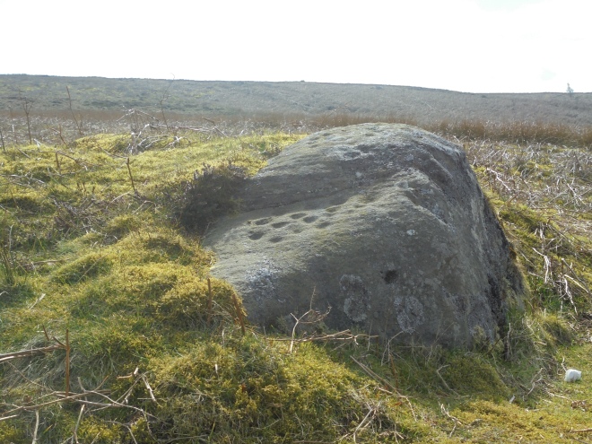
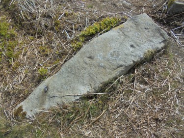
The first stretch of the walk in a south-easterly direction leads to the first find of the day, and, what I can only describe as the least interesting of any of the day’s discoveries, it’s both unnamed and easily missed, it was only a stroke of luck that I noticed it, plus the fact that it stands on the footpath I was following. The stones are notoriously difficult to find, and, without a 10 figure grid reference reading on the GPS, well, such as this one, would be virtually impossible.
On this unnamed stone, I could see maybe six cups and no rings, whether this was due to weathering and erosion or there were no rings cut, I don’t know, but, a find is a find, and this was a great start to the day. It’s fair to say, due to the stone lacking as much interest as many of the others in regards to its surface, that may be the reason it has no name and remains nothing more than a chronological number on the moor’s finds list, but, this really is the least interesting on the route, they really do improve with quality as progress is made.
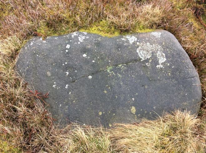
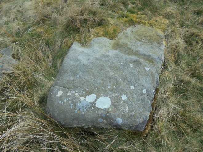
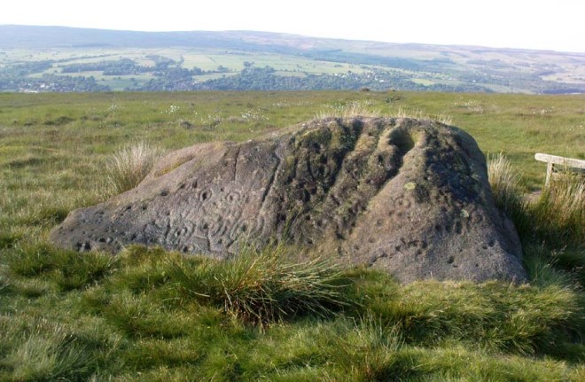
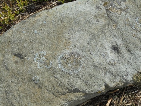
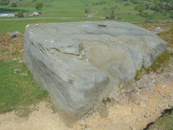
Following the route and GPS leads to the second stone and, in my opinion, one of the best I’ve ever discovered, the Barmishaw Stone which, due to the winter terrain, was so much easier to find than it was initially when I discovered it during the summer, then, it stood hidden and surrounded by deep and thick ferns, when, although it stands close to an ancient track, it remained completely hidden to view.
This stone is home to some of Ilkley Moor’s speciality carvings, ladders, which consist of parallel grooves linked by perpendicular ‘rungs’, which, so far are unique to this and the Panorama Stone. As with many of the moor’s carvings, these seem somewhat difficult to see, (weather depending), but if my research is correct, there are 6 in ladder form and 24 cups, 9 of which have rings.
About half a kilometer away, heading WNW, was the next port of call, the Willy Hall Stone, which, is situated in Willy Hall’s Wood, who was Willy Hall? Whoever he was, the location which bears his name is believed to have once been a very sacred spot, and, it’s easy to see why whilst you’re there. The stone is on a mound which is surrounded by 2 streams which drain off Green Gates and rejoin one another at the bottom of the mound at Willy Hall’s Spout. The stream then takes route into Ilkley, under Brooke Street where it joins the River Wharfe near the bridge close to where the Roman fort of Olicana once stood.


As I was close to the Willy Hall, I met a hiker, he was doing a horseshoe route and heading back to his destination, (the Cow and Calf pub being his half way point and return), we had a little chat, he was telling me, how, he’d forgotten his compass but felt comfortable with his map, knowing where north was, and, with his experience, he felt comfortable following his route. He told me he was on the Millenium Way, sadly, he wasn’t, he was on a track about 100 yards above it. I’m not criticising him at all, he wasn’t far from where he thought he was, he wasn’t lost and he was heading in the right direction. But, he told me he was ‘old school’ and confident with nothing more than his map. I didn’t challenge him, nor did I criticise him, but, I don’t agree with his thinking. I’m a believer of using every piece of modern technology which exists. Finding these stones without a 10 figure GPS reading would, with some of them, be virtually impossible, plus, I know exactly where I am in any weather or condition, and, as yet, I have found every single stone and carving I’ve been looking for, in my opinion, if the technology is available, use it, not only do you know exactly where you are, in ANY weather condition, but so do the Mountain Rescue, should you need to contact them, (so long as you have a phone signal), modern technology is a life saver.
After discovering the Willy Hall Stone, realising I had walked past in on numerous previous occasions, and, like many others, being completely unaware of the wonderful carvings adorned upon it, I took a south-westerly route in search of the illusive Pitchfork Stone. My route was nothing more than a short horseshoe, starting and finishing at the same point, although there were other carved stones within the area, I hadn’t included them, it was simply a basic route I’d devised with some interesting features along it. Finding the Pepperpot was a first, I’d only read about it and never seen it. It’s only a few yards from another ancient trackway and another wonderful discovery. On display are an estimated 50 cups on its upper part with another 17 on its lower part, well, how many more lay beneath the moss which covers over a third of the stone which is covered in moss, it needs removing, regardless of some may disagree, I’m a great believer the removal of the moss will reveal more, and, the acidic soil erodes any potential carvings at a faster rate than exposure to daylight and weathering does, it makes sense to remove the moss. Once at the wonderful stone, there’s very little dispute to why it received the name it has.


For the sake of practice, I took a map and compass bearing for the next stone, the Pitchfork. on the horizon, a stone seemed prominent, it matched the bearing, so, towards it I headed, on what seemed, the longest empty stretch of my route. I didn’t stay on the footpath which ran adjacent to some wonderful woodland for long, I headed into the wild moorland in the direction of the prominent stone, believing, in my own ability that I would easily find the Pitchfork, not that I had any idea of what it looked like. The south-westerly hike gave me plenty of time to ponder over the 2 roe deer I’d seen earlier, those wonderful animals roaming free on the open moorland, pure eye candy, unlike the decomposing sheep I’d seen earlier, (I’d have taken its skull as an ornament had it not been full of brain tissue).
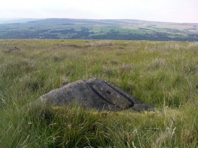
The Pitchfork is situated on the brow of the hill, an exposed area, close to a footpath but on the wild and windy moorland, it certainly wasn’t the large and prominent, isolated rock I’d imagined it to be on my compass bearing, far from it, it was hidden and very difficult to find, but, eventually, find it I did, I was stood on the stone before I saw the carving, this one is a tester for anybody to find, the buzz of finding it was a pure highlight, and, it stands on an alignment with other unmarked stones, another puzzle for potential explanations to their meanings?
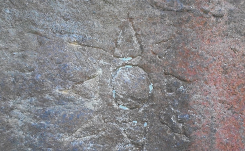
The above photo was taken at the GR reference I had found, the cup and ring carving is absolutely wonderful, but, I did question why on earth it took the name Pitchfork, I questioned it, but, left it there. It really is a wonderful cup and ring carving, an absolute gem, but, having since researched the stone for information regarding it, I discovered that this stone, isn’t the Pitchfork as I’d previously being led to believe, it’s a wonderful stone and carving but not the one I’d come in search of.
Having believed I’d found the Pitchfork, I headed towards my next one, one of the moor’s most famous and visited, it even has a bench for tired walkers located close to it.
This is probably one of the most impressive carved stones on the entire moor, this photograph wasn’t mine, the daylight made mine worthless by comparison, so, I have used this as a replacement, a far superior one. Over a metre high and 3 metres in length, it has over 95 cups, rings, interlinking grooves and gutters, and, an incomplete swastika.
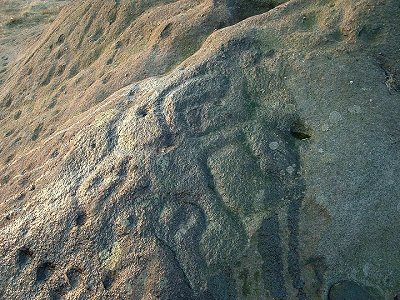
It’s worth bearing in mind, the swastika, as it’s remembered today, was a negative symbol corrupted by Hitler in the 1930’s and since then has been revered. Sadly, it will never be seen as anything other, but, prior to that dark period in the 20th century, it had a positive meaning and in some parts of the world, it still has. This carving predates Nazism by a few thousand years, so, it should be respected, as all the other carvings, as nothing other than it was intended, a symbol of good fortune and hope for all.
There was more than a touch of irony as I headed for my 7th stone after leaving this wonderful piece of rock art, the weather was changing for the worse, a black cloud was heading over from the east, the temperature was dropping and I could sense rain wasn’t far behind. The Neb Stone was my next destination, a welcome descent from the bleak and windy plateau I’d been covering for the previous hour.
The Neb Stone is more of a landmark stone than any other, although there are a few possible cup carvings on its surface, maybe the Neolithic inhabitants deemed it unworthy of their handy carving, we’ll never know, but, like many others surrounding it, this prominent stone is both interesting and worthy of a visit. As I approached the Neb, whilst crossing the tracked part of Keighley Road, there were 2 female German tourists heading down the road towards Ilkley, we said hello and they asked if they were on the correct road for the town, I told them they were and, after observing their shoes and clothing, encouraged them to make haste their descent into town, the rain was very soon to dominate the day, and, they certainly weren’t prepared for it, like anywhere in the hills and fells, even on a warm day, it’s essential to prepare for a change in the weather, at the very least, some waterproof clothing, sturdy shoes or boots and, no denim jeans, these two weren’t prepared and, unless they hurried, would feel the full force of the oncoming storm.
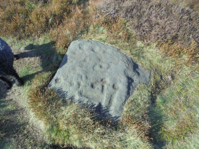
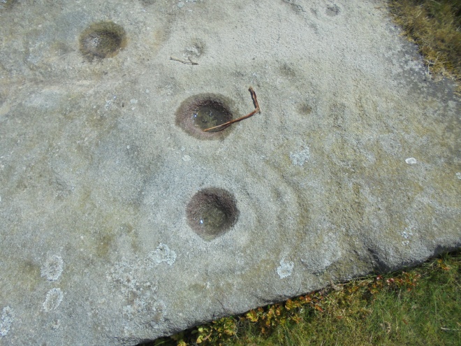
My final stone, and my 8th of the day was a particular friend of mine, not only am I responsible for removing the moss both from its surface and around its edges, which revealed more hidden and buried carvings, it was the last place I spent some time with Wendy before her sudden death, she was my former partner, my son’s mother and without doubt, my best friend. She joined me on my last visit and helped me finalize the cleaning of the stone, so too did she find what I believe to be a stone axe head, something I still need to be checked out by the experts, she was in her element in a pair of hiking boots and up to her knees in a muddy field, she was a legend and she is deeply missed.
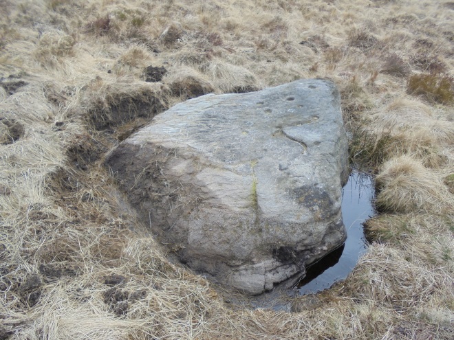
Located on Weary Stone Hill, this stone demands views over the Wharfe valley towards Bolton Abbey and Great Whernside. Prior to it being cleaned and having the surface moss removed, more than half of the surface was buried by it, there were 12 cups and some rings visible, since it’s cleaning, there are now at least 4 more cups clearly seen. Removal of the acidic peat moss not only reveals the hidden carvings, it prolongs their lifespan, it appears that the soil and moss erode the stone at a faster rate than being exposed to the elements would.
So, having completed this horseshoe walk at the wonderful Weary Stone, the circular walk was now completed with only a hundred yards to go to the car. It’s not a difficult walk with only one ascent, the difficulty is finding the appropriate and correct stones, one of which failed me as I had an incorrect grid reference number. Still good fun and a wonderful way to spend a full afternoon, I recommend it to anyone, don’t forget the correct clothing, map and GPS.
Dedicated to Wendy Joanne Barnes – 1/12/1966 – 25/11/2017
Rock Art and the Ilkley Style – Part 1
This was a walk with a difference, unlike any other, navigation was as basic as any, the distance wasn’t in any way challenging, and, as for isolation, that too was a complete no, but, as for escapism, they certainly don’t come any better. The music I selected for the blog was historically inaccurate, but, the sound, the mood, the language, the aura it creates, well, from my point of view, was perfect. (Then again, we are in the land of Trolls, paganism, sacrifice and neolithic carved stone symbols, an area so spiritual, the most heathen of pagans can taste it, Stonehenge eat your heart out, so, there is a connection to the wonderful Swedish folk song and from my location, only a few miles north stands an isolated, hidden and secretive valley, Trollers Ghyll, thus, any time difference the historians of whichever ology, choose to curse me with, I challenge them to do it).
What are Cup and Ring carvings? – They are basically symbols (petroglyphs) which have been carved into rocks. Although they appear in other countries, in Britain they are found mainly in the north and Scotland. They are believed to be between 4000 and 5000 years old which places them in the same time period as the construction of Stonehenge, the Neolithic and Bronze Age period.
What to look for:- Cupmarks, these are hollows cut into the surfaces of rocks which can be singular or in groups.
Cup and Ring Marks, A central singular cup surrounded by singular or multiple rings.
Cups, Rings and Channels, These can be cups and rings with ladders or channel joining them together.
These 3 are the most common in Britain although there are many more designs such as, spiral chambers, cups in rosette patterns, chevron channels, ladders, grid and curl like motifs.
After close examination of uneroded carvings, it was deducted that the carvings were pecked into the stone using tools with about a 5mm point with metal, flint or deer antler been the most likely tool used. The only real facts about the carvings meanings are, and will probably remain the only known facts, are, there is no clear picture of their real purpose.
There are some clues:-
* The carvings are situated close to or incorporated within burial mounds and cairns, there may be a link with burial practices, ancestral connections or the after life.
* They are also found on standing stones and close to stone circles, locations believed to have both ritual and religious purposes.
* They frequently appear on outcrop rock where there is an uninterupted view over the surrounding terrain, indicating, their locations had been specifically chosen, bearing in mind, at this period of time, most of the terrain was heavily wooded.
This outing was the first of three on this, an area I consider, one of the least understood and most metaphysical locations on the planet. I’m not alone thinking that, I know two people whose ashes are scattered on the moor, both parents of friends who, for whatever reason, asked for their remains to be shed there, so, it makes me wonder, how many others have done the same, what is the attraction and why?
The route was simplicity itself, nothing technical or difficult, about 6km in total with a return journey being the reverse of the outward, on a very well-defined, ancient footpath, there are many testing and far more difficult walks in the area, but, on this occasion, that wasn’t the purpose of my visit. I’d come in search of neolithic stone carvings and there became the challenge, finding them. On this occasion, they were all adjacent to the footpath, for reasons I will explain later, but, they’re not all obvious, and, if I was a gambling man, I’d place good money that the majority of walkers are oblivious to the carvings and stroll past unaware of their existence, just as I used to.
From the church I followed the road west for a couple of minutes till I saw the entrance to the moor at Hetchell Ghyll, ascending this overgrown, wild and picturesque ghyll to the, westerly bound, required footpath is a pleasure in itself.


Emerging from the woods onto the westward bound footpath, which is also part of the long distance routes of the Millenium Way and the relatively new Dales High Way, it’s like leaving a jungle for a bleak moonscape, maybe an unfair comparison, but the change really is that immediate and instant, there’s no gradual gradient. Bear right, and onward, the second and probably, the most famous stone carving on Ilkley Moor, the world-famous Swastika Stone.


By far the most famous carved rock in the moor and, still the most mysterious in age, origin and understanding. Completely unique to the British Isles but almost identical to the Camonica Rose in Val Camonica, (Bresica, Italy), which suggests to some, there may be a connection to Roman troops situated at the outpost in Ilkley, which, would cancel the believed date of the original carving. There are enough suggestions to its meaning to drive anybody to the verge of insanity, the bottom line was, and remains, nobody knows. There are 9 cups within and around the 4 curves, with an additional and random curve to the top right with its own cup within. (Well, I’m not going to start to add all the random and wild suggestions to their representation, instead, I’m going to offer my own, the 9 cups are there to represent the 9 worlds of Viking Norse mythology with the 10th and outside one representing an expanding outlook! It was carved by the maverick, Soren the Norse as he roamed these lands in search of wild boar and continued his never ending battles against the Trolls from their homeland a few miles away close to Appletreewick, let’s face it, during winter, these parts certainly have the feel of Nifhelm). One there for the many ….ologists to contend with.
Only a few yards away, on the opposite side of the footpath, laid there like dormant stone coffin lids are 2 fallen stone gateposts, not that their carved structures would immediately strike the average passer-by to their original purpose, that is, if the average passer-by should actually observe them, I never had, and, I’m quite a fine representative of the average passer by, one of the gateposts plays host to 2 cup carvings. In my humble
opinion, these are more confusing than any other carving I’d yet discovered, there is no visible evidence to why the stones are there, there is no visible boundary for the posts to represent, nor are there any visible signs to where they formally stood, but, the carved cups are very visible within one of them.
Onward and westerly I continued, next stop, the Anvil Stone, this one, did cause a little self-inflicted confusion. The GPS I was using, is, in my opinion, the best thing since sliced bread, but, it does have a single fault, man, or in my case, me! As long as the GR number is correctly added, it will find a needle in a haystack, or in this case, any stone required, the thing is, you have to ensure the figures added are correct, one error and you could be miles away, and, in this instance, I placed 03 where I should have inserted 30, and, I was about 100 yards out, on a hillside with hundreds of stones scattered around, but, after appearing a complete eccentric loonatic to the young couple sat above me on the hillside, I eventually found the temporarily illusive stone.


I climbed onto it and looked carefully for any carvings, and, although there were many indents into the surface, if they were originally cups, or cup and rings, then in this case, time, weather and erosion had delivered a particularly harsh blow upon them and it was particularly difficult for me, with my untrained eye, to decipher if they were or had been natural or man-made. Still, a magnificent stone with, space beneath for shelter or, as has been suggested, burial.


There’s no disputing I wasn’t feeling very pleased with myself, the route took no working out, but the stones, well, they aren’t sign posted so it’s still a pleasant feeling individually identifying them.
Five done, (including the gate post), two to do, that meant, continuing along to the Noon Stone and the famous and prominent Doubler Stones, they all seem to have unusual and interesting names, who named them and why were the selected names chosen? Maybe I’d find an answer for the next one, the Noon Stone, another few hundred yards along the track to find it.


The day had been wonderful, not a great distance covered, but, slow due to the interest and discoveries, now came a little more effort, the footpath needed maybe another mile completing prior to reaching my final destination, there was a left turn at the junction known as Windgate Nick prior to about half a mile’s walk to the famous Doublers’.


So, after spending half an hour or so climbing around and on top of the unusual and quite incredible Doublers, it was time to return on my outward route back to the car. My canine companion, the never tiring Mountain Meg, didn’t seem to mind which way we went, so, after a little self appraisal at achieving my target on the first attempt, the hour or so return walk to the car began. Another successful day in the hills.
GO STRAIGHT TO HELL BOYS – GO STRAIGHT TO HELL GHYLL
Having just watched one of the best documentaries I have ever seen, an hour-long, brilliantly filmed testimony to one of the Lake Districts finest, Blencathra and Sharp Edge, the memories of my visit there 30+ years ago came flooding back, we climbed it in bad weather, low cloud, mist and drizzle, we scrambled the ridge and at one point, I lifted myself up one of the rugged rocks, pulled myself up and almost over the shiny, slippy rock, as my head and shoulders ascended the edge, the view awaiting me was, to say the least, very memorable, a sheer drop of maybe 500 feet below me to Scales Tarn, I can still feel that absorbing breath of shock which immediately absorbed me, one of the most memorable breaths of my life. The point I’m eventually and gradually making is quite simply, that such a wonderful documentary will guarantee an over population of Blencathra (Saddleback to the purists), and, for me, the Lake District is and always has been, over populated, the beauty of the entire region guarantees it. This mass of people, for me, defeats the object of the challenge and the solo trip. Navigation is made easy when you can ask for guidance and directions, check with others of your location, where to aim for if you feel lost and isolated, how to react if you do become lost, these skills are vital to learn for yourself, that’s why, I choose quieter locations, new to me, and, often, in poor weather, that way, each outing I take, my skills improve, and that’s my target; you never know, one day I may master it!
So, why Hell Ghyll, simple, until recently I’d never heard of it, and, it’s located in an area I’m unfamiliar with, on a route I’d never walked, and, as it happened, on a day of cloud and mist, more challenging to navigate and free from people! Basically, with a name like that, the attraction was instant!
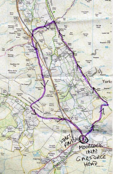
The route was roughly a 7 mile horseshoe with the wonderful looking pub at its start and finish, not that I’d have the opportunity to sample its fine ales, my visit was a day one and, from what I could see, there were no facilities for camping, (I may be wrong on that one, I hope so, the location is wonderful for various alternative walking routes, so, outside a pub, would be a marvellous spot to pitch a tent for a couple of days).


In February, in the Yorkshire Dales, usually, there are 2 kinds of weather, rain, or, it’s about to start raining, it suits me fine, I’m prepared for it, and, it virtually guarantees the hills and dales, if only for a few hours, belong to me, and only me. Lost in this world of silent contemplation I can forget about everything and any issues or problems that may be on my mind.
People put time recommendations on routes such as these, I think this one had a 3 hour time attached to it, who decides such times? Why are they suggested, if a walk such as this takes me 10 hours, I’m happy with it, I try not to look at my watch if possible, watching the clock instead of the scenery simply defeats the purpose of being there.


Had I been there a few days earlier, the sound of the trains running along the Settle-Carlisle railway line in the valley below, would have been powered by steam engines, as, during the previous weekend, as part of the celebrations of the reopening of the line, steam engines had been running along the famously scenic route.


The weather had been unfavourable all day, and, as the hours progressed, it gradually deteriorated, there was no heavy rain, it was simply becoming mistier, wetter and heavier in dull, grey cloud. It didn’t deter my day, it simply spoiled the views of this magnificent valley and the surrounding terrain.


High Hall, formerly an inn called the Highway House, on a well-used route through the mountains – well used, not only by nobility, but also by drovers, tradespeople, and highwaymen, too. And Mary Queen of Scots is said to have passed along it in 1568, on her way from Carlisle to imprisonment in Bolton Castle.

THE DALES HIGH WAY was conceived in 2007 by husband and wife, Tony and Chris Grogan. It’s a 90 mile route across the high points of the Yorkshire Dales. It starts in Saltaire and finishes in Appleby with a return journey via the Settle-Carlisle railway line. Since March 2014 the route has been shown on OS leisure maps, and it is recognised by the Long Distance Walkers Association. It is described on Bradford’s official tourism site and the Yorkshire Dales National Park website. An informal “Friends of A Dales High Way” group has been established.
The High Way really was as it’s name suggests, an ancient road, well known as an important route through the hills and dales, how many feet have walked across it, how many incidents have occurred on it, how many lives have been lost along it, who knows, I certainly don’t.
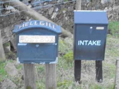
Dating from 1825, Hell Ghyll Bridge is a single arch span which replaced an earlier structure. One of the parapets houses a particular stone which is believed to be an original boundary stone between the traditional counties of the West Riding of Yorkshire and Westmorland, the true counties, I always choose to ignore the ludicrous boundary changes introduced in 1974.
Prior to reaching Hell Ghyll Bridge, (who named it that and why?), all the ghylls, streams and becks were feeders for the River Ure below, the county border really did leap out and define itself here, Hell Ghyll is a feeder for the River Eden. It’s entirely Westmorland and is one of the few large rivers in England that flows northwards. The source of the river is on the high limestone fells above Mallerstang Common, near the West Riding border, and makes its way across eastern Westmorland, with the hills of the North Pennines to the East, and the fells of the Lake District to the west, to Carlisle. Here it merges with other rivers to form the great Solway Firth estuary, before reaching the open sea, 90 miles (145 km) from its source.
The River Ure is approximately 74 miles (119 km) long from its source to the point where it changes its name to the River Ouse. It is the principal river of Wensleydale, which is the only one of the major dales now named after a village rather than its river. The old name for the valley was Yoredale after the river that runs through it.It’s is one of many rivers and waterways that drain the Dales into the River Ouse. Tributaries of the Ure include the River Swale and the River Skell.
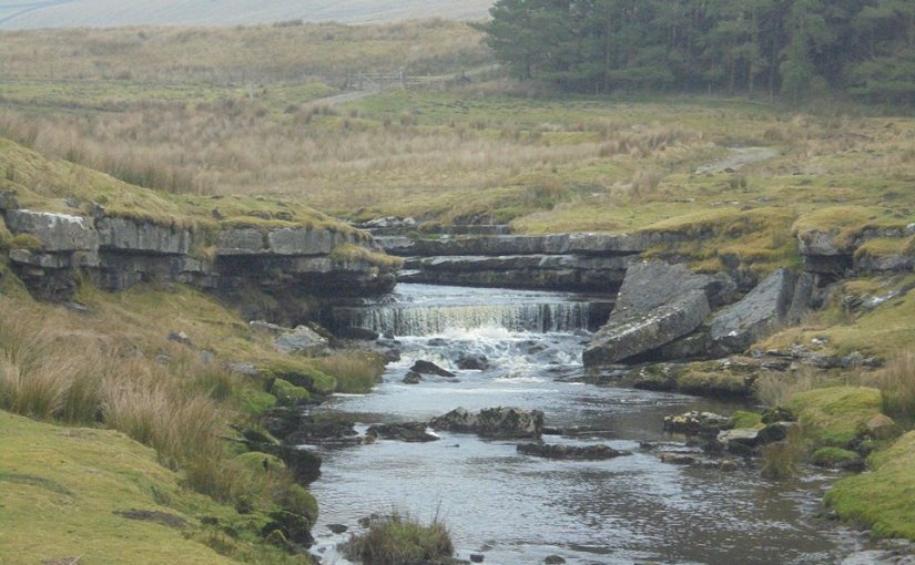
I felt as though I’d almost achieved my target, not my complete route, I’d only achieved half of that, but, Hell Ghyll was the mysterious object of desire and, without any real difficulty, I’d found it, a feeling of gratification.
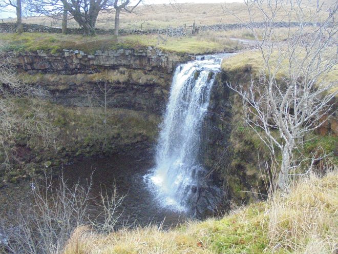
Although it had been a wet and drizzly day, it hadn’t rained heavily, had it done so, the surrounding view and running water would have been tremendously more aggressive. Once at the base of the stream, there it was, in all it’s magnificence, Hell Ghyll Force. The waterfall is a single drop fall of around 8 metres (25 feet). Hell Ghyll, which begins its life as Red Ghyll, is fed by water rising from the High Seat range of fells. I was informed that, as part of the Duke of Edinburgh Award, on conclusion, participants were expected to leap into the pool at the waterfall’s base, not something I intended to copy, not that day.
At this half way point it was time for some refreshment, even with all the modern equipment and fast boiling cooking kit, this was the occasion to divulge into the traditional pre-made sandwiches and a flask of piping hot coffee. At least the coffee was mine, the sandwiches I had to share, old Mountain Meg simply stared at me the moment I’d sat down and opened my snack, it takes a stronger person than myself to refuse a hungry hound some tuna sandwiches, besides, she was great company and she deserved every bit.
I was surprised to see how close to the waterfall stood the Settle-Carlisle railway line, maybe 200 yards from each other and the waterfall is clearly visible from the train.
My intention had been to return to the car via a route ascending Grisedale Common on the opposite side of the valley. A walk through clearly defined marsh and bog, with an ascent to the common, prior to returning to the car. I departed with a full intention of completing the route, but, only a few minutes into it I had second thoughts. The terrain was saturated, and, the marsh was unforgiving. Each step through it requires twice, or even three times the effort of an established track or footpath, the mist and cloud were covering the summits and the drizzle was turning into rain, I made the executive decision to descend back to the road and opt for the easier option. I took the direct route and found myself confronted with a dry stone wall, as I climbed over it (had I damaged it I would have immediately repaired it), I slipped and fell backwards into the marsh, I was saturated, soaked to the skin, a shame, but these things happen.

Printing error – The sign should read, Welcome to Westmorland

Printing error – A single sign should replace both – Welcome to the West Riding of Yorkshire

Lunds Viaduct with it’s distinct 5 arches, Settle-Carlisle line

Shotlock Tunnel, Settle-Carlisle line
“And I Bring You FIRE”- A pyromaniacs dream come true
OK, call me a whimp, but, solo wild camping in winter doesn’t deter me, I love been out in the snow and ice, it’s the 8 hours of daylight that’s the disincentive, the thought of the isolation, in sub-zero temperatures is one thing, the thought of having to spend up to 16 hours of it in total darkness, simply lacks the appeal to me as it may not to others, even with the potential of watching downloaded films on the Ipad, the fact remains, I’d still be stuck within the confines of a bivi or one man tent for 16 hours, exposed to the elements, in the middle of mist filled cloud, and possibly, snow, ice and constant rain or sleet absorbing the terrain, it really doesn’t sound like much fun. There are only so many spoons you can whittle in one night, besides, once the shavings fall inside the sleeping bag, well, it would be worse than the Highlands and Lake District midges.
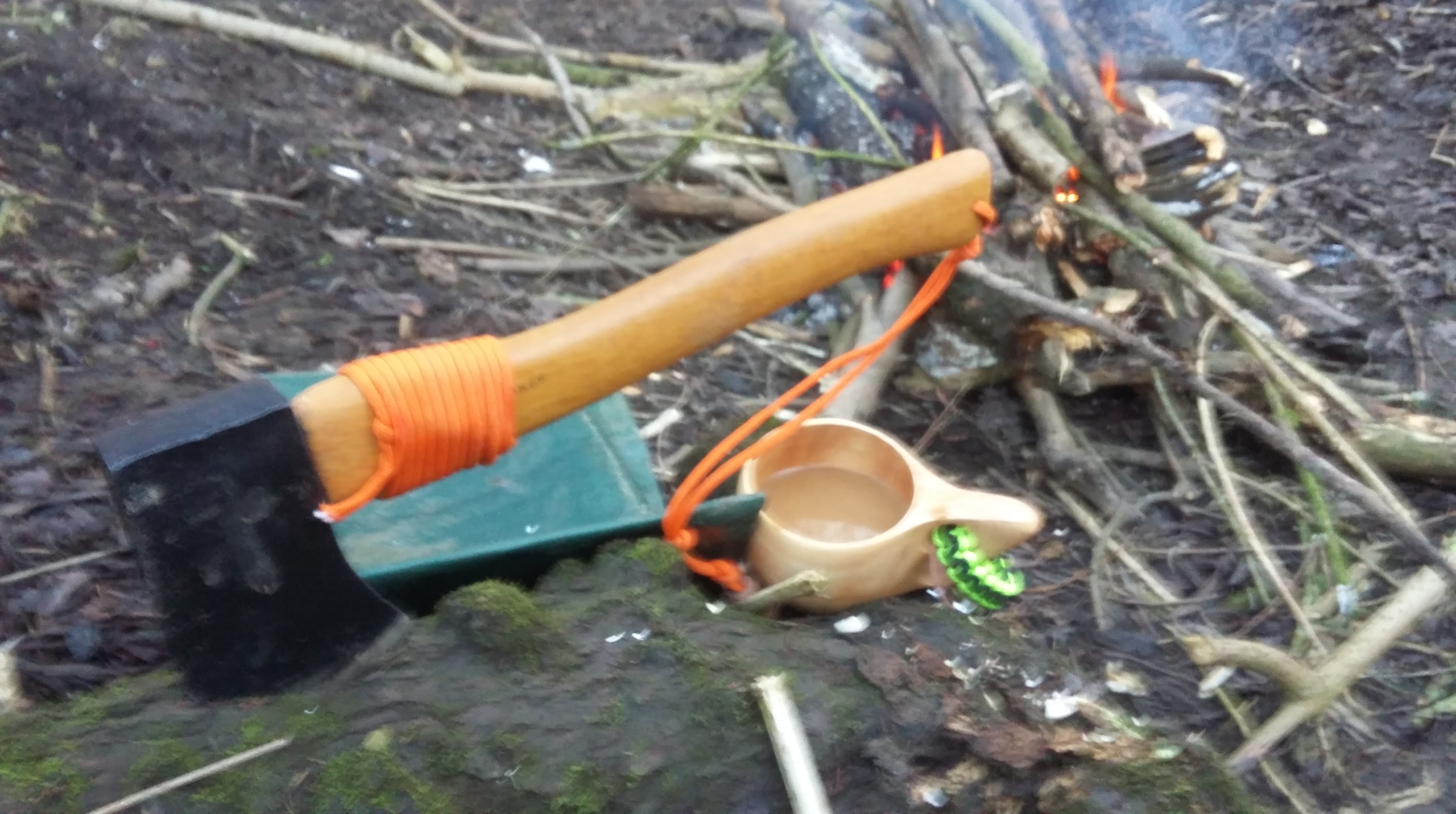
So, as I have rediscovered my love for the outdoors, I needed to discover a new alternative. I’ve been a devotee to Ray Mears for many years, and, Paul Kirtley certainly knows his stuff too, as do many others. With the assistance of the marvelous YouTube, and, so many hours of watching many publications, I decided to venture to the woods and make an attempt at the first and foremost necessities of the outdoors, fire-making, with a ferro rod, steel, tinder and kindling, which, in January, in northern England, one of the wettest and frozen parts of the UK, the testing challenge certainly was awaiting me.
Another, and probably one of the biggest challenge, was finding some secluded woodland which doesn’t have, ‘Private’, ‘No Camping’ or ‘No Fires’ signs daubed all over them, especially, been situated so close to a major English city. What little woodland there is available, much of it really is littered with heavy traffic, I’m not the only one who enjoys the benefits of wild woodland.
The greatest natural ally for fire-making in the outdoors is the deciduous Silver Birch. I’m not going to pretend I’ve magically transformed into some kind of woodsman overnight, I certainly haven’t, but, this particular tree offers bushcraft, amongst other things, a bark which can be used for both tinder and fire-starting, a nutritious sap which can be tapped and drank, the bark can be heated and the resin collected, which is useful as a waterproof glue and again, helpful for fire starting. Plus, if you visit Canada with Ray Mears, he’ll take you to a native American who, minus instructions or a plan, can, transform the bark and timber into a traditional canoe.
Now let’s be realistic here, if my memory serves me right, man has made fire since forever and a day, and even earlier than that, which, really does pre-date Swan Vesta, Ronson or the legendary Zippo, not to mention the 10 for £1 disposables readily available on any swag market stall in the country, so, it’s fair to suggest, that today’s modern hi-tech equivalent, old Homo Sapiens, [citation needed] should easily equal and surpass these ancient people’s, we’ve progressed, haven’t we? In my new Swanndri shirt I felt like an oversized Hobbit but, the question remained, could I step back in time 4,000 years and equal primitive man? That, was the question. Who fears progress?
This is how it’s done, (not the fire, she’s cheating, but the rest, the shelter, bedding and cooking, she’s good), the thing is, where on earth, around my neck of the woods, would it be possible to find a traffic free spot, in the woods, where you could construct something as good as this? Thank you Survival Lilly 🙂
The landscape I was searching for was heavily wooded, close to running water, isolated and free from traffic, and hopefully, containing Silver Birch and dead standing trees, I’d no intention of destroying anything living, that wasn’t on the agenda.
The location I found, was close to the Ebor Way footpath, far from been isolated or free from traffic and as far as silver birch were concerned, there wasn’t one to be seen for miles around, but, the decision for the location was simple, it was tucked away down an embankment, adjacent to the river, an area, which on viewing, was frequently flooded and an over flow for the main river, and, absolutely abundant with dead driftwood, there was more dead wood around me than in a timber yard, and, even without the silver birch, this was a superb spot to practice fire making, especially as I was now using my own tinder and nothing more, the challenge awaited.
The next step probably was the most time-consuming of the entire manufacturing process, that been, the collection and distribution of the required materials.
“The greater the need for fire, the greater the difficulty in its manufacture”
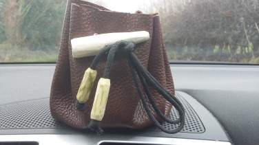
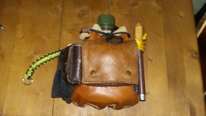
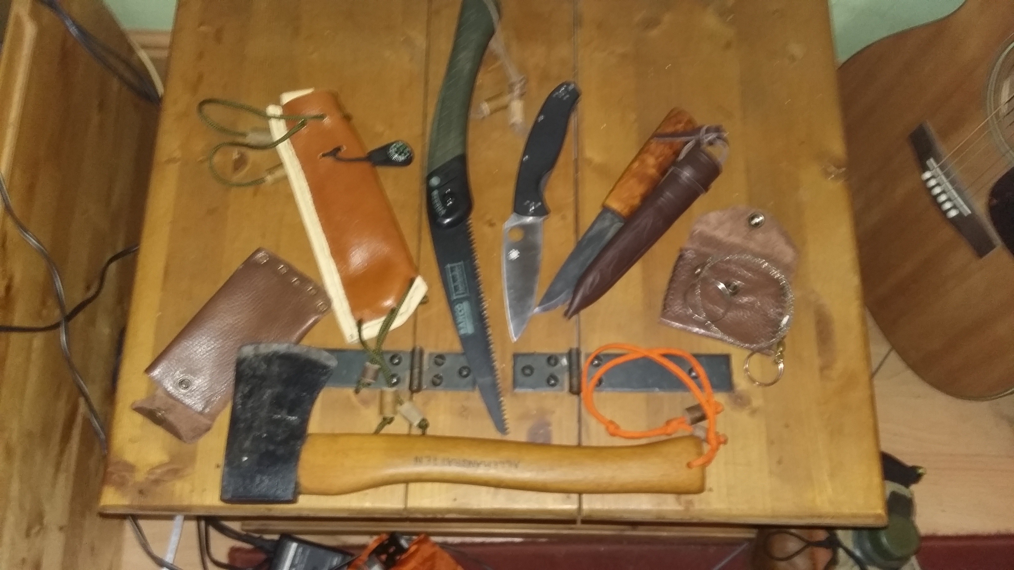
Preparation is imperative and following the simple initial procedure really does ensure the end result flows smoother, I had a tinder pouch with a variety of potential contents, old man’s beard, silver birch bark, cotton wool, cotton wool soaked in fat/dripping, old bicycle inner tube – cut down into small pieces and a piece of magnesium block, I’d yet to find and prepare any fatwood. The ferro rod and striker were itching to make their debut.
“Manufacturing fire really does warm you three times, the first, collecting the firewood, the second, igniting the tinder, and third, the fire itself!”
It took me, probably, the best part of an hour to prepare the location and collect all the wood, due to the terrain it wasn’t difficult, dry and dead wood littered the area, dead bracken lay everywhere, to say I was only yards from a river, a river that floods and can be treacherous, the debris it had gifted me during its last flood was abundant.
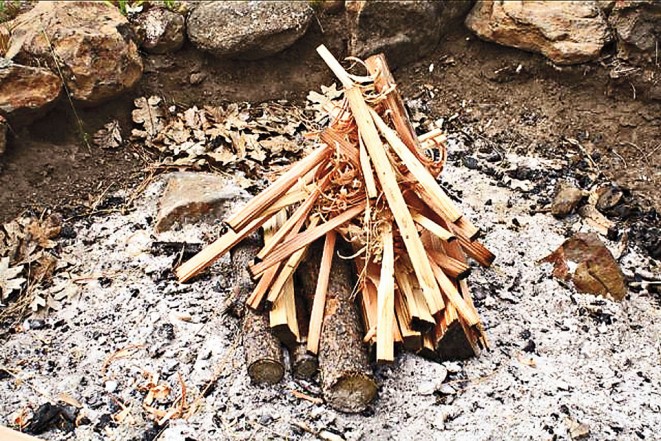
Excluding the tinder, the 3 required stages are as follows, 1:- a pile of dead twigs, dry leaves, bracken, or anything small and combustible enough to take a small flame, 2:- a second pile of bigger twigs, small branches, roughly between 10 and 20mm in diameter, then, 3:- the bigger and substantial content for the fire, the dead and hopefully dry logs, if they seem too wet, take the axe to them and split them into smaller, dryer pieces, usually, the centre of random logs will be reasonably dry, the more the merrier.
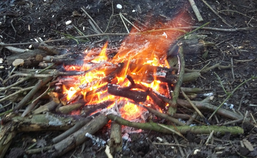
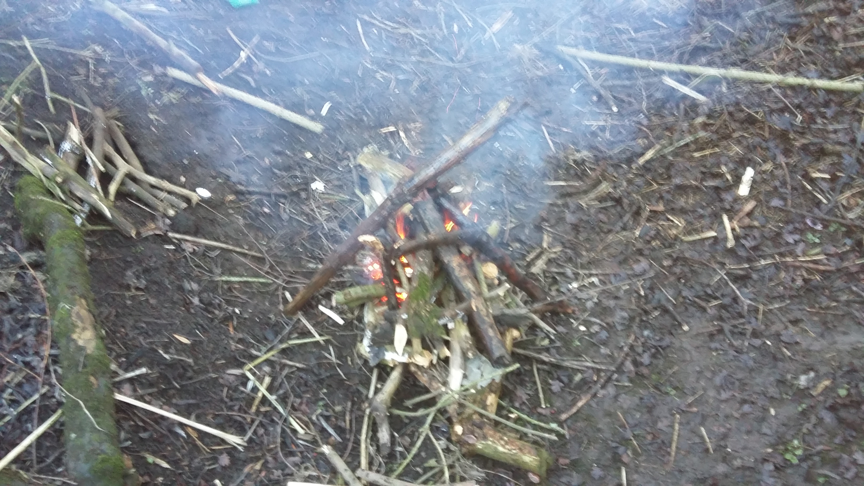
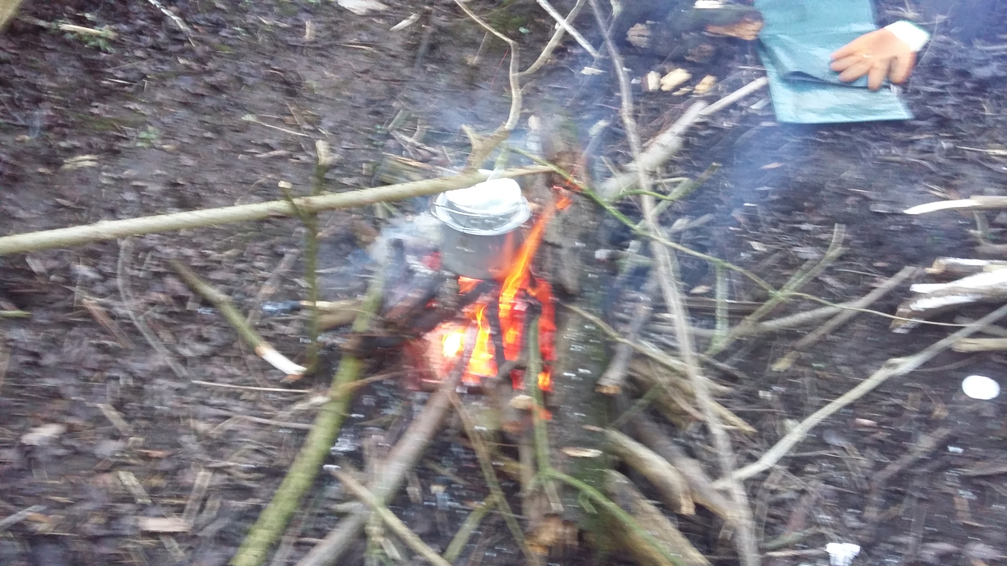
So, the moment of truth finally arrived, the preparation completed and a pile of twigs and dry leafs collated on the surface of the base logs, the neat piles of the following stages located at arms reach, some cotton wool and rubber inner tube placed within the kindling, and, we’re off. Had they still failed, I could have soaked the cotton wool tinder with the used cooking fat, I had in a tin in my rucksack, or shaved and feather the centre of a piece of the thicker logs I’d collected, adding more dry and combustible content, but, fortunately, it deemed unnecessary. The ferro rod sparked immediately, and the cotton wool ignited, and, for a moment I thought I’d achieved immediate success, not this time, unfortunately the kindling didn’t immediately take to flame. With my second attempt, I ignited the rubber from the cotton wool, and, although everything was slightly damp, the kindling took to the combination or rubber and cotton wool, and, hey presto, I had fire, a wonderful feeling.
I’d anticipated the result to take longer and be more difficult, but, I’d made it easier, simply by preparation and planning, by collecting all the required elements, having them close at hand and available. If I can do it, anybody can do it. Referring back to the base logs, it’s also useful to lay two more stage 2 bits of wood between the base and the tinder/kindling, if the 2 pieces are laid in an inverted V shape, hanging beyond the fire so the two ends could be used as handles, should the kindling require a little air blowing inside to encourage the flame to emerge, it’s possible to, relatively safely, lift everything, using the V shaped sticks, and blow at the kindling to assist the flames to manufacture.
Summary, for a first attempt I was quite satisfied, there are things I could have done to have improved it, such as increase the base platform by adding more logs, it’s something I’ll take with me for next time, I could have stockpiled more reserve fuel, but, I wasn’t intending to stay too long, my challenge was simply to build a fire and, I achieved it, and, it was superb practice, my methods worked for me and I learnt a lot, so, with this little extra knowledge gained, next time, I’ll be there to advance myself a little more, I’m looking forward to it.
And finally, the golden rule applied, Leave No Trace or Leave Only Footprints, even though the area where I’d been, will, without doubt, flood in the next few weeks or even days, my conscience dictated my decision, so, I scattered the ashes and covered the location with wet leaves and mud, conscience cleared.
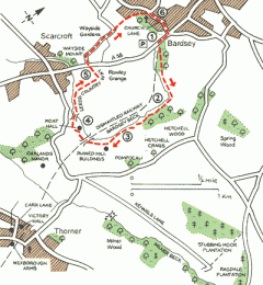
Roman Forts and Priest Hole Escape Routes – Bardsey and Scarcroft
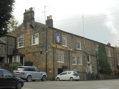
Two locations of which I can only describe as been completely off my usual beaten track, but, in the same breath, two locations with an interesting history and unusual attractions, the fact that they both stand about a fifteen minute drive from my home, and I’m very familiar with both villages, and, numerous villagers, proved sufficient enough for me to spend a dull autumn Saturday afternoon investigating for myself. Not that the Bardsey pub, The Bingley Arms, needed a great deal of investigation, over the years, I’ve spent many an hour or two investigating the fine ales available there!
Both villages stand within an invisible line on the map known as ‘The Golden Triangle’, the reason being, the area within it’s borders, North Leeds, York and Wetherby, are said to be amongst some of the wealthiest in the UK, two streets in Scarcroft, Ling Lane and Bracken Park are the most expensive in Leeds, and probably, the rest of Yorkshire. There lay the interesting question of how you define wealth? Needless to say, on this occasion, my visit wasn’t to hunt for a new home, I’ll leave that for another day, it was a far less expensive visit, that been to follow a walking route which would lead me to the alleged oldest pub in England and an ‘off the road’, hidden and almost unknown, Roman Hill Fort.
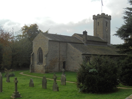
The route was relatively short, about 3 miles, maximum 4, with a section of it following an undisputed old roman road. Starting at The Bingley Arms in Bardsey, joining the A58 for about 100 yards, southerly, prior to crossing the road and entering Hetchell Woods and following the footpath to Pompocali Roman Fort, then, heading back on the horseshoe route into Bardsey via Scarcroft.
Now, let’s not dwell on me been some kind of local history buff or expert, I’m definitely not, I have a strong interest in my local surroundings and the historical value they contain, but, that’s where it ends; but, it really did come as a surprise that I’d never previously heard of this Roman Fort a few miles up the road from my home with a very Italian name of Pompacali, up Pomay? Nor am I a closet police detective, but, Pompacali does have a very Italian ring to it, and, not a particularly Roman one, but, that’s only my very amateur opinion, regardless, this one had to be seen.


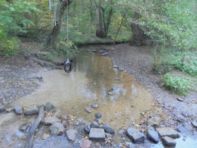
Hetchell Wood, to me, is the epitome of how a woodland should be, dense, limited sunlight, a variety of trees and vegetation, boggy in parts, steep and flooded areas, and, almost teaming in wildlife, overgrown with broken trees and moss covered rocks and branches littering and decomposing en masse. Perfect escapism.
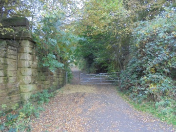
Not only does this magnificent woodland subscribe to all of the aforesaid, further hidden gems are simply awaiting discovery. There used to be a railway line running through the area on the Leeds – Wetherby line, this ran through many of the local villages, including Scarcroft, Thorner, Bardsey and Linton but, in 1963 during the Beeching cuts, this line, like so many others, was closed, leaving only the haunting remains of stone bridges and cuts in the ground where the trains once ran.
Whilst I was hovering around the first impressive visual evidence of the former railway I’d encountered, I had the pleasure of meeting a really friendly local man who, like myself, was walking his dogs, we started chatting about the terrain and its history, where, very enthusiastically, he asked me to follow him to witness for myself, the Roman remains of the potential, seemingly anonymous, hill fort.


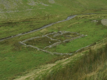
To discover this outstanding, obviously man-made landscape came as an exciting and wonderful surprise, the Pompocali Roman Fort. Breathtaking as it appeared, a Roman fort remains, at least in my amateur mind, disputable. There’s no denying it’s lacking any strategic location and a superb defensive quality, there’s quite a strangely romantic aura in the surroundings, not excluding the very prominent Roman road leading to and from the location. The problem is, sites such as this, throughout Britain, are listed and recognised by English Heritage, they are, to a certain degree, protected and appear in the history books and, latter-day, social media sites, this doesn’t. To me, the mounds appeared somewhat random and none uniformed, there was no stonework anywhere, no evidence there had ever been any. I’m not convinced. The minor roman road running alongside the site may be, as some suggest, been used for transporting the granite from nearby quarrying, and, the numerous mounds been the resulting spoils from the digging, to me, that sounds more feasible, maybe it’s a job for Tony Robinson and the Time Team?
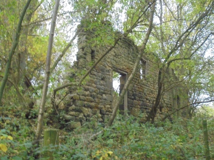
Following the footpath of the Leeds Way, it wasn’t long before I’d discovered another fascinating ruin, this been of a former corn grinding mill, from its appearance and rather diminished remains, it appeared that a more recent form of quarrying had occurred and most of it had been recycled, but, this too, must have had an important role in its day, especially for the local farming community.


Onward, returning towards the affluent neighboring village of Scarcroft, I continued. The local and surrounding roads I’m very familiar with, I drive around them on a weekly basis, but, taking time to leave them and venture ‘off the beaten track’, (literally), can be both rewarding and gratifying, it takes such little effort to discover so much.
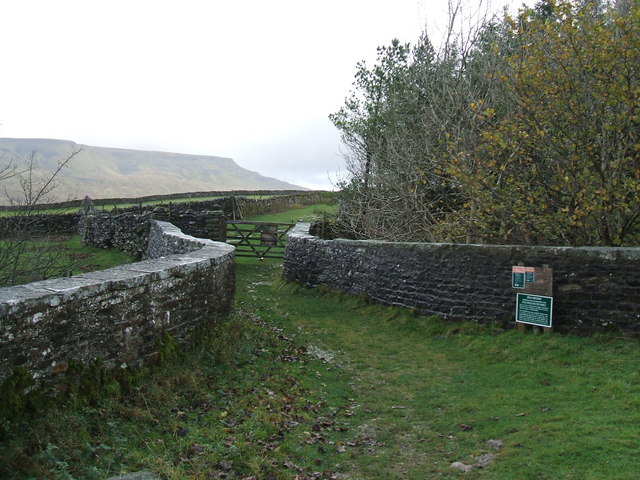
My destination was now the New Inn, the only pub or amenity in this ridiculously over priced suburb/village. The pub is located on the A58 Wetherby Road and was constructed in 1852, for a while, a few years ago, its name was changed to the Bracken Fox, then, in 2011, it reverted back to its original name of the New Inn, I’m guessing, but it was originally a staging post for horse-drawn traffic using the roads. The present building is a 1930s roadhouse which stands on the site of the original one. So too does it seem too coincidental that it’s located on a cross roads junction, opposite the old toll house. The Toll Bar House, (pictured below), was used between 1826 and 1876 when a toll system was in place between Wetherby and Leeds.


The pub is close to an area known locally as Wayside, I’m sure there is an interesting history to this part of the suburbs of Bardsey and Scarcroft, but, sadly I’m unaware of any of it, the two streets standing there is Wayside Crescent and Wayside Mount, the latter been situated on a bridleway, and, my return route to Bardsey cum Rigton and the Bingley Arms, my starting point. Another pair of local streets where the house prices defy logic.
Following the bridleway back towards Bardsey it took me down a footpath which reminded me of an old friend of mine who, very sadly, passed away a while ago, Billy Gilmore, a larger than life local character and former police officer. He was almost of celebrity status within the area, to such an extent, that, on news of his death, the local newspaper, featured a full-page article about him. I think this footpath was his short-cut home after his very frequent visits to his local, The Bingley Arms, even if it wasn’t, in Billy’s memory, it deserves the title I have given it. A little story between Billy and myself was, many years ago, whist sharing a pint with him in another pub a few miles away at Moortown Corner. The long gone Chained Bull, in the days when 10.30pm was the Sunday closing time, I complained to him how I was frustrated at having to go home at such an unearthly hour, he asked me if I wanted to go elsewhere for a while and another drink, needless to say, he took me across the city to a sports club, where, at 5am on Monday morning, we finally left and headed back across the city, home, I failed to make it to work that day, RIP Billy.
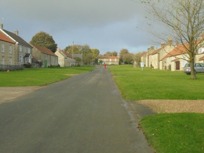
Bardsey cum Rigton, my starting and termination point for this enlightening little blog of mine, for a village of its relatively small size, has more than one claim to fame. A sports club with a cricket and football team. Its mentioned in the 1086 Domesday Book as “Berdesei” and “Bereleseie”. A motte and bailey castle dating back to post 1066, and, the birthplace of playwright and poet William Congreave – (Hell hath no wrath like a woman scorned, twas WC and not Shakespeare who gave us this much used and very true line of phrase). Lastly, and not least, the famous Bingley Arms. Originally named The Priests Inn. It proudly claims to be the oldest pub in Britain, with a history dating back to between AD 905 and AD 953, and says that it served as a safe house for persecuted Catholic priests, and also as a courthouse from around AD 1000 from which offenders were taken to the pillory across the road.
Within the chimney, in the main part of the building, stand secretly hidden are two priest holes dating back to 1539AD. Here Catholic priests hid for safety following the Dissolution of the Monasteries by King Henry VIII. Priest holes are not rare, but it’s uncommon to find two in the same location. During alterations to the building in the 1700s a wonderful stone inglenook fireplace was discovered. It takes pride of place in the tap-room next to a fully-functioning Dutch oven for bread production – one of the few to still be in its original position in the country.
In 1780 the Inn was renamed, the Bingley Arms, after it was taken over by Lord Bingley. With such a rich history it’s no wonder that its had its fair share of ghostly occurences over the years. Objects have moved or disappeared, pans of water have boiled on stoves whilst switched off and candles have ignited on their own. Several ghosts have also been spotted at the pub. A cavalier, known as a practical joker with a great sense of humour, has been seen by staff dressed in fine clothes with a large hat, a young girl is said to have been responsible for strange activity and a mysterious dog has been seen walking around by visitors.
I was once talking to a resident who lives on the hill which looks down onto the village, he claimed, that during constructing an extension to his house, and digging the new foundations, they discovered brickwork which turned out to be part of an escape tunnel, leading from the pub to the top of the village.
No, not an average outing to the dales, mountains, fells and moors of northern Britain, no wild camping or navigating through wild wilderness, bleak and weather beaten, exposed terrain, but, a couple of hours walking, discovering wonderful hidden gems, only a few minutes drive from my own home, I may live in north Leeds, but, surprisingly, just beyond the fringes of the ‘Golden Triangle’, that may be something I can live with, regardless, a wonderful Saturday afternoon.
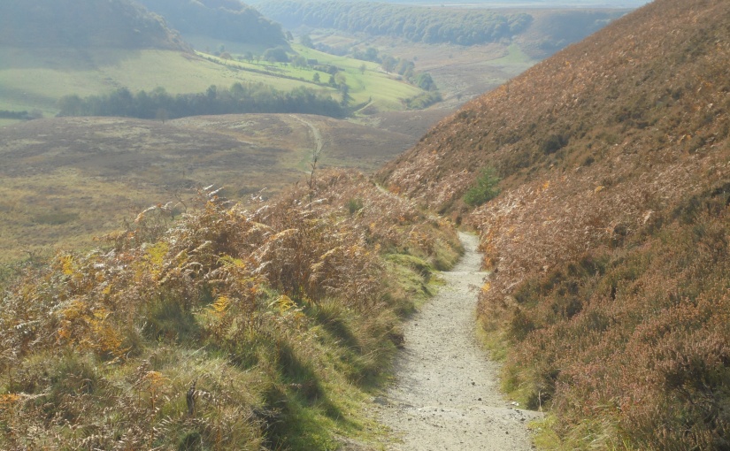
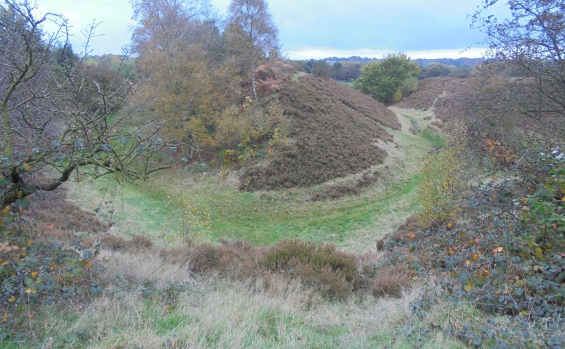
The Hole of Horcum – ‘The Devil’s Punchbowl’ – North York Moors
The Hole of Horcum is located on the North York Moors, (not the North Yorks or the North Yorkshire Moors, as some suggest, they don’t exist), in the Tabular Hills, (an east west line of distinct hills running from Scarborough in the east to the Black Hambleton hills in the west). It stands within a section of a valley known as the Levisham Beck, upstream of two local hidden villages, Levisham and Lockston, both of which pre-date the domesday book.
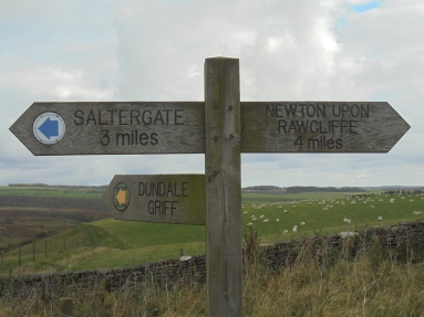
There are two suggested starting points for this walk, one being Levisham, where, it starts and concludes at the village pub, and the second being the viewing point at Saltergate on the busy A169. Needless to say where my decision lay, even if I have ‘been on the wagon’ for almost a year. To me, a walk like this deserves such a scenic English village as its first and last port o’ call.
There are two theories regarding the formation of this 400 feet deep and 3/4 mile wide unusual hollow in the ground. One claims how the gorge was created by a natural process known as ‘spring sapping’, a process where the water which has welled up from the hillsides, gradually undermines the slopes, slowly eroding the rocks, and, over thousands of years, gradually forming the valley as it slowly, both widens and deepens into this huge and deep cauldron, a process continuing to present day.
The second, and in my opinion, discarding all this geological nonsense regarding its creation derives from a Saxon giant known as Wade, who, by today’s standards may have been considered to have anger management issues. He was certainly famous and legendary, as, he features in, amongst others, the works of both Chaucer and Thomas Malory. I’m not sure if he was a local giant or simply travelling through the area, either way, he was with his wife, and, I’m not too sure what really happened, nobody ever understands what really happens with couples behind closed doors, it depends who tells their story first, either way, it’s fair to say they had a row, it could have been after a session on the mead? But, it resulted in Wade hurling a huge mound of mud at his estranged wife, and, probably due to the over consumption of mead, and, fortunately for her, his shot missed and landed on the location of Horcum Hole, thus creating the aforesaid hole in the ground, and, that’s the version of its creation I trust to be the truth.
I think Wade named it too, who else could have given us a location which is said to be the tenth rudest place-name in Britain, a true Saxon sense of humor.
The opening 3 miles of the walk is relatively easy, clearly defined and quite bleak regarding viewpoints and landmarks, but, looks can be deceiving as I’ll explain later, the history of the landscape is both interesting and historic. The return route is taken after accessing a wooden gate at the Saltergate junction with the A169 close to the viewpoint and car park on the roadside. Then, descending the footpath down into the Hole and gorge below, prior to following Levisham Beck back to the village, en route, there’s an alternative choice of route, one avoiding the difficult woodland walk and taking a route known as ‘The Griff’, or, the one I followed through the woodland.
Crossing the moor I soon discovered I was far from being alone, it’s a popular walk, easily accessible from the main road and enjoyed by many who appeared to have taken a chance as they drove by and decided to venture along the walk. For a while, after seeing these people, I felt somewhat overdressed and over prepared. Only a few other walkers seemed correctly kitted out for the outdoor weather and elements. People in jeans, training shoes, shorts, thin jackets, etc, carrying nothing for inclement weather, it seemed so strange to me, but, after a little thought, it was their lookout, even, if been realistic, the terrain wasn’t particularly dangerous or too far from help, but, my personal experience derives from the boy scout motto, be prepared, and, I do try to be.
On first sight the open moor seems quite bleak and featureless, it’s deceiving. It’s full of history and archaeological remains, from bronze age burrows, iron age boundary dykes, mounds, ditches, banks and ridges, evidence of burial sites, fortified farmsteads, enclosures and field systems are all confirmation of a once populated area, although, from the footpath, none of them are particularly easy to see.


Emerging at the bottom of Levisham came as quite a relief, the last mile had been quite difficult and a real sting at the end of the walk. There too was the benefit of being in the quiet and sedate village, the Horseshoe Inn has a splendid reputation for fine ales and good food, a temptation I’m sure many would benefit from after a few hours in the open air, sadly for me, I wasn’t to benefit from such a delight, it was time for my homeward journey. How did I rate the walk in this wonderful part of North Yorkshire, on the North York Moors in the old North Riding, a reet good ‘un.
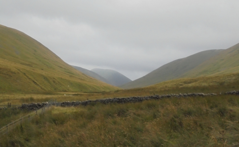
THE BOWDERDALE & THE CALF HORSESHOE – THE HOWGILLS – WESTMORLAND
En-route to these northern delights, I always drive via Skipton, the gateway to the Dales, and, this also takes me passed the village of Addingham, which sits alongside the River Wharfe between Skipton and Ilkley. Although there’s little relevance to my blog, hike and wild camp, I have a wonderful story about the village which I find intriguing and incredible, and, because of that, I feel a desire to share it, mainly because, each time I pass by, I think of it so it does become part of every trip.
- “AD 867. The army went from East Anglia over the Humber’s mouth to York in Northumbria. There was great discord in this people amongst themselves; they had overthrown their king, Osbriht, and had taken an unnatural king, Aelle. They decided late in the year that they were going to fight the others, yet they gathered a great army and sought the force (Vikings) at York, they broke into the fort; some went in and there was immeasurable slaughter among the Northumbrians, some inside and some outside. The kings were both killed, and the survivors made peace with the force. The same year, bishop Ealhstan died; he had the bishoric at Sherbourne for fifty years, and his body lies there in the churchyard.”
- Fearing for his life, Archbishop Wulfhere of York, fled to Addingham where he remained until 875 until he was recalled to York by the then Christian Danish ruler of the city, Guthred. Remaining in York until his death in 900. An interesting story I always think of when I’m driving past the village.
After my aborted and disastrous previous visit, this time, I was definitely following the map and designated footpaths, no shortcuts through fields containing cattle, no barbed wired walls to climb and no unnecessary difficult terrain to scramble over, this time I was going to complete it, something I had convinced myself of..
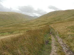
The walk is about 12 miles long and, although the ascent to the Calf isn’t easy, I’ve known many greater challenging ones. The route basically heads south from the tiny hamlet of Bowderdale following the valley basin adjacent to the Bowderdale Beck, before ascending the footpath to The Calf. then, reversing the route in a northerly direction along the wonderful Dales High Way footpath, over the gently rolling summits of the Bowderdale Ridge home to Hazelgill Knott and West Fell prior to descending back to Bowderdale.
Initially, I found (as I usually do), the opening footpath awkward to find, on this occasion I shouldn’t have done, but, I became confused regarding the visible choice of two, and, where each one led, basically, as the OS map clearly displays, it’s a matter of following the outside of the dry stone walls, where, the path takes the upward or downward route, one taking the lower walk along the beck, and the other, taking the ascent to the summit route.
As recommended I chose the lower route to follow, starting at 1500 hrs, this walk can easily be completed in a single journey within a few hours, depending on age and fitness, but, for me, it’s the wild camp challenge of which I choose to participate, so, if I commence at late afternoon, it gives me time to complete half, prior to bedding down overnight and completing it the following morning, that way, for me, I achieve the best of both worlds.
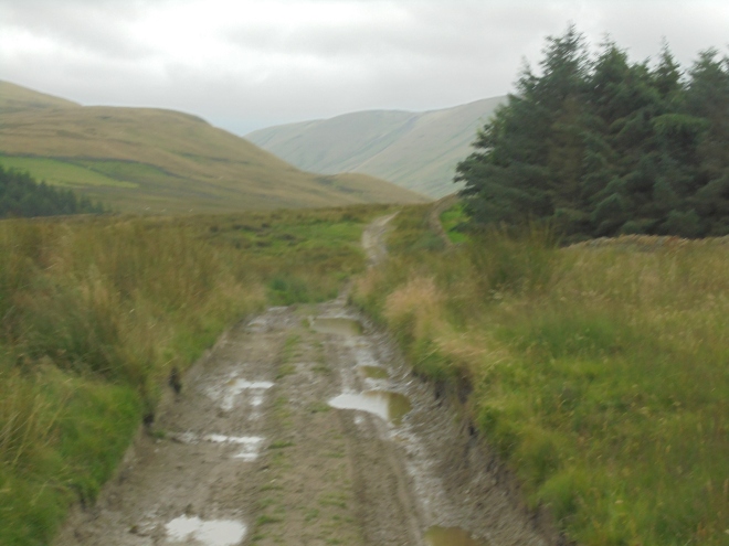
The footpath is exceptionally good, (once I’d discovered it), and, although it was a cloudy, late summers day, the terrain was saturated, I don’t know why I bothered purchasing my canvas summer boots, they’re no use at any time in the mountains of northern Britain, regardless should I feel the desire to wear them. The biting cold wind funnelled down the valley as I trudged along this bleak location, surrounded by these gargantuan, bleak and featureless herd of sleeping elephants. The only visible evidence of any other recent human activity were those from a single mountain bike and it’s tracks, and, like myself, at certain saturated parts of the footpath, the rider had obviously sunk into the marshy ground.
It’s not surprising they are called the lonely Howgills, it’s not a location for the autophobic. Not that my canine companion noticed anything in the form of an obstacle, she was, as always, in her element, bouncing through the landscape as though it was her second home, she was in her element and enjoying every second of it.


The ascent to the Calf commenced at Ram’s Ghyll, where, the stream runs down to Bowderdale Beck and the ascending footpath veers to the right, for me, after this wonderful but testing, wet and very windy trail, this seemed an excellent spot to take a rest and make myself a well deserved coffee, and, as it was the last running water on the map, top up my two water bottles and purify the contents. Clean water on summit ridges isn’t always readily available, and, for my evening meal and hot drinks, water is essential, not to mention, for the following days refreshment, a little forethought can reduce a potentially difficult situation. This break gave me the opportunity to add a plaster to a blister which I’d acquired on one of my toes, a small blister but irritating and annoying, a simple plaster covering it and the problems solved, a small detail but one better been addressed than neglected.


The ascent for the Calf wasn’t too aggressive, I’ve done many more severe ones, but, it’s still an ascent and none are easy, this one was simply less strenuous than so many others that I’ve done, and, as my old legs are definitely lacking the strength they once had, it soon became very noticeable that I was ascending. The rewards for this effort, as always, awaited me. Unfortunately, as it was early evening, the weather was deteriorating, the clouds were becoming darker and full of threatening rain. The thing is, if you wait for sunny warm weather before venturing out, you’ll never go, so, be prepared for the worst weather, hope for the best, and, just do it.
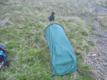
I reached my destination sooner than I’d anticipated, but, entering the Dragon’s Den of summit camping, the weather isn’t going to improve. Level and sheltered locations aren’t easy to find and exposure to the elements is guaranteed, on a more positive note, isolation is virtually guaranteed, not necessarily peace and quiet, strong winds, thunder and lightening, hail and storms are always a potential for a wonderful nights sleep, but, solitude is almost confirmed, so thought I!
I discovered a little, seemingly level, little dip where I pitched my bivi, at the time I didn’t realise just how close I was to the summit footpath and ridge, a matter of yards, but, the dip did provide me with some shelter from the now biting cold wind and mist which had covered and surrounded me. I’d fed Meg, fed myself with a boil in the bag meal, (in future I’m bringing my own pre cooked meals), made myself a hot coffee, and, I was sat perched on a little step overlooking the pitch black valley below. I love these moments, drifting away into my alter ego of the wandering Norseman, thinking about Saga’s and runic stone carvings, wondering to which Pagan god would be guiding and protecting me, it turned out that the message would come via a shaggy, curly haired, smelly black dog sat alongside me.
The ever alert and very protective Meg suddenly and protectively, broke into alert mode, I recognise her sense of reaction and immediately realised that we weren’t alone, she’s amazing, for a soft, daft dog, she’s as sharp as a razor. I turned around to see a fellow lone walker only a few yards away descending the footpath towards the valley below. Good old Meg. It turned out he was heading for the waterfalls around the nearby Cautley Spout, but, he wasn’t too sure which way to take from our present spot. He was a young lad, in his early 20’s, and like myself, spending the night on the hills. We chatted for a few minutes and he was gone, I’m not too sure about walking in the dark in search of Cautley Spout, that certainly is pushing the safety barrier, one slip around there and it really is good night. I knew which direction they were located but I didn’t tell him, simply because I knew of the dangers, so, in the end, he aimed for the lights coming from a farm house at the bottom of the valley, and, informed me of his intention to return to Sedbergh the following morning, after he’d camped out, a safer decision, we said our farewells and he was gone.
The rain came down all night, due to my weight, the gradient and gravity, the bivi slid down slightly, tearing the 2 canvas loops which held the tent pegs at the front, thus collapsing the arched front. It wasn’t an evening to become claustrophobic, and, it would ensure some necessary repairs once I’d reached home.
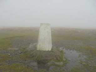
Once awake it was time to make a move, I fed Meg, packed the kit away and ventured for the Calf’s trig point, no home comforts but a necessary part of the agenda. After taking a grid reference reading, I realised I was only a few yards from the trig point, and, not far from the Dales High Way footpath junction which separated the ascending one. At some point I must have crossed it but I certainly didn’t see it, this caused a little confusion, as, it hadn’t vanished, it was around there somewhere? It turned out to be located alongside a flooded area, and, after another check on my map and GPS, I walked to where it should be and happily discovered it, a little tester, not something I needed on that wet, windy and rainy morning, but, at least I’d found it, the Dales Head Way footpath and my second part of the journey and the homeward bound section, the decent.


I was still relatively dry even though the mist and cloud were doing there worst, the bivi had gathered condensation, but managed to keep the rain out, my new goretex jacket was incredible, my second one, a lighter and thinner version of my winter one, and, ideal for the conditions. Now, all I could hope for was the blowing cloud would disperse and supply me with the wonderful ridge summit views I was constantly been tormented with, it could occur at any second, and, it may not have, I remained an optimist. On my ascent I’d had a brief view of the Calf, it appeared for a couple of seconds as an intimidating black solid carbuncle in the distance, but, that was as much as it displayed itself.
The return journey across the Bowderdale Ridge did improve as the cloud passed over and the terrain became visible, thus ensuring I’d received full benefit for my efforts. The surrounding hills and valleys are absolutely breath taking and magnetic, this wonderful, ignored landscape, the forgotten Howgills, they are absolutely outstanding, shared almost equally between the traditional counties of Westmorland and the West Riding of Yorkshire, and, on this occasion I’d even crossed over from my home county to Westmorland, a worthy piece of treason by my standards.
The descent went well, the surrounding fells and dales eventually came into view, the Langdale valley to my left opened up and displayed its treasures, the pleasure of been there, descending and having the entire area to myself, well, it takes some understanding why they are the least favourable in the area, they have just as much to offer as the Lakes and Dales, but, that’s my secret and I’m keeping it to myself.


The Bowderdale Washout – The Howgills
How’s your glass, half full or half empty? Well, it is British summertime, so, the chances of some sunshine, although slim, is possible, and, the weather forecast had informed us that although that particular Friday would be cloudy, the following day would be warm and sunny. Well, if you have a desire to be out in the northern English fells, you need your glass to be half full, otherwise, you’d never venture anywhere. From my point of view, it could be the sunniest day on record, and I’d still carry all the required 4 season layers in my rucksack, thinner layers, but still, the same amount.
My new found love affair with The Howgills, (situated in the north of England, divided almost equally with north and south sections of the traditional counties of Westmorland and the West Riding of Yorkshire), greatly influenced my decision to discover this new dale, valley and horseshoe route.
I should have known there could be some issues awaiting me as I approached Kirkby Lonsdale and passed the county sign for Lancashire, a strange part of the world indeed, best to be avoided at all costs, but, that’s another story.
Bowderdale, not only does it not register on my old Tom Tom satellite navigation, but, actually discovering its location is a alone an incredible challenge. The walk I’d intended to follow from Bowderdale to The Calf, took the valley basin footpath to the summit, prior, after a wild camp, back to Bowderdale via the summit bridleway, absorbing the fell summits of Hazelgill Knot and West Fell, both on the northern route of the Dales High Way, a walk of about 12 miles covering, from what I’d imagined to be, some of the most beautiful scenery the Howgills has to offer. I was eager to commence.
Over population during this route wasn’t something I anticipated!
So, having fought for a parking space and avoided the threat of a traffic wardens ticket, and, applied my boots, rucksack and wonderful Fjallraven trousers, (I hate name and label dropping, but these really are worth every penny), and, calmed down my over excited companion, the famous cockapoodle canine Mountain Meg, it was time for my journey to commence.
Discovering the starting point wasn’t an issue for this one, after following the road for a few yards there was a sign pointing in the required direction stating the bridleway, a pleasant change. The bridleway was part of the Dales High Way, a route I intended to take on my return journey, the outward route ran parallel to it, but, on the valley basin, basically, following the stream, Bowderdale Beck, for most of the way, prior to ascending for the Calf at Ram’s Gill (GR 678988), and, a severe ascent, just what the doctor ordered after a 5 mile hike.
I followed the bridleway sign at Bowderdale, a few yards up the tarmacked road from the houses, the weather was threatening but like I said earlier, my glass was still half full. Mountain Meg’s enthusiasm equalled that of a Siberian tiger, which, I was soon to discover was to become a slight problem. On the brow of the hill in the field I was intending to cross were a herd of cows, with calves and, a prominent bull. How did I know there was a bull amongst the happy grazing group, simple really, he was behaving bullishly, as only a bull could do. OK, it’s not the end of the world, a slight change in my route, after all, it was eventually taking me along the valley basin, adjacent to the beck, who fears change?
The track was wet, it was muddy, there were no previous footprints, again, to be expected in this isolated part of the world, had this been my objective then I’d certainly hit the jackpot!
Due to no visible footpath it soon became apparent that I was on grazing land and, according to the map, there were a couple of dry stone wall boundaries ahead of me, no problem, I’m a fan of dry stone walls, and, when I need to climb over them I ensure I commit no damage and, whenever possible, replace displaced parts. I’d done nothing wrong, I hadn’t intended to climb over walls, but, it seemed that was soon to become my only option, I’d followed the sign displaying the bridleway and taken the direction of the valley.
I descended to the beck, that was the route, I’d simply joined it earlier than I’d anticipated, underfoot was the difficult marshy, boggy and moss covered terrain, this was becoming a slog, each footstep sank ankle deep into the water and within minutes my feet were saturated, this wasn’t the best of starts I’d ever had, and, it was certainly draining my still aching legs from the previous outing a few days earlier, never mind thought I, it would soon improve!
We continued, parts of the bank had collapsed into the beck, this meant steep climbs over and around the landslips, when, on reaching the top of them, I could see the herd, they were heading in our direction, probably descending the valley side for a drink, again, this wasn’t too impressive, we were been stalked by a herd of cows and a horny bull in open land with nowhere really where we could escape from them. Make haste for the first dry stone wall thought I, a hop over it and freedom, no problem, come on Mountain Meg, let’s go. squelsh, sink, thwump, exert and pull, each step, this wasn’t fun, it wasn’t something I was unaccustomed to, but, that wasn’t the issue, that old piece of oncoming prime steak and his harem were becoming more than a slight concern, the first dry stone wall couldn’t come fast enough.
There it was, a well constructed wall with a delightful, inviting barbed wire fence attached to the corner of it, the signs of walkers unwelcome didn’t need displaying, the message was loud and clear, so, in this wonderful valley, I was cornered with the approaching potential of been stampeded and crushed to death, a little disheartening in such a cold and isolated location?
Once the wall was cleared, it couldn’t come fast enough, we continued, a feeling of liberation from a potentially awkward situation came as a slight relief, the terrain underfoot was now another issue, my boots and feet were now waterlogged, the alleged footpath displayed no signs of ever emerging, I had to ascend steep riverbank erosions to bypass them, only to discover that bloody herd of livestock were now in the second field, I couldn’t believe it, they must have known of an opening in the wall that I didn’t, hardly surprising as they were at home in those fields and I was nothing more than a gypsy passer by. I daren’t ascend the fields in search of the illusive footpath, in a game of confrontation I’d only win the runners up medal, not something on the days agenda, continue I had to, over the physically draining terrain towards the next stone wall obstacle and potential liberation.
After we’d continued, maybe another mile, and, escaped the potential interests of Bully, the Daisy’s, and their offspring, I actually stopped for a break, that wasn’t easy, finding a dry spot in that marshy location was another challenge, finally I found one and, when I looked at Mountain Meg, she’d decided to perfume herself in some of the plentiful cow clap that littered the entire area, she rolled over, straight on her back into the biggest pile available, it may have been dry and crusty on the surface, but, once she’d rolled onto it for a couple of seconds, she’d succeeded in breaking through it’s crusty surface and smeared it over her entire back and body, why do dogs do that, are they reverting back to their hunting and survival days and aiming to hide their scent by blending in with the terrain, I don’t know?
It was then I studied the surrounding fells, they were cloud and mist capped, all of them, the clouds were black and appearing ready to open and discharge themselves, this simply wasn’t my day, what was the point of continuing another 3 miles onto cloud covered summits to camp down for the night, it would be nothing more than a viewless ascent into rain and unnecessary difficulty, with potential for danger and problems, no, on this occasion, I decided to accept defeat and head back. So, having checked the area for Bully Beef and Co, having a clear view of them on higher ground, I retraced my disappointing journey back to Bowderdale and the car.
Bowderdale is a beautiful valley, it’s challenging, a little more than I’d expected on my initial arrival, but, I will be returning, but, only when the weather improves, I’ll be taking Mountain Meg and the footpath above the fields where the livestock graze, but, I will be back to conquer this quiet and wonderful Westmorland valley, so, Bowderdale, until we meet again, I bid you farewell.
I’ll add a little summary to this outing, the valley is hidden and quite difficult to find, it’s obviously not a popular route as the lack of footprints and to be honest, the lack of a visible footpath, seem to confirm, it is wonderful for escapism, there isn’t an abundance of hidden locations similar to this one in England’s national parks, but, the lanscape underfoot alongside the beck is horrendously difficult, it’s not a pleasure walking through marsh, bog and moss, the constant climbs around the eroded river bank only adds to the difficulty, there are many easier walks in the area to be done, but, my stubbornness dictates and I will be returning to complete this one and hopefully, take more photographs and avoid the livestock.
Sedbergh – Cautley Spout – The Calf – Calders – Sedbergh. The Howgills
I’ll start this blog with a viewpoint regarding geography and county boundaries. The Howgill Fells are a small group of about 40 hills situated in the north of England. They sit almost triangularly between the towns of Sedbergh, Kirkby Stephen and Tebay, almost divided in half with northern and southern sections. The northern half sitting in the county of Westmorland and the southern half sitting in the West Riding of Yorkshire’s Sedbergh District. Although I was born in the Claro District it was a real pleasure to visit the Sedbergh District, so, if these named locations are relevant on my birth certificate, they are still very relevant to me. 1974 boundary changes introduced by suited bureaucrats sat behind desks in Civic Halls, to me, have no meaning or value, the Vikings gave us the Ridings, (Thridings = third) and, if they were good enough for them, they’re certainly good enough for me.


Sedbergh sits at the convergence of four rivers, the Rawthey, Clough, Dee and Lune, a beautiful dales town that even features in the Domesday Book. This was my first visit and I was very impressed with the comfortable feel of this historic old market town, other than it had a famous public school, (where, incidentally, a distant relative of mine (very distant), has only recently left), I knew very little else about it. Dwarved by the mighty Howgills it was very popular with the legendary lakeland author Alfred Wainwright and his works include some of its many surrounding fells. An historic town, Sedbergh has been a thriving community for hundreds of years, with a market dating from the 13th Century. The town was a staging point for commercial routes across the Pennines. Dating from Saxon times, it still displays clear reminders of the influence of the subsequent Saxons, Vikings and Normans. The town has immense character including cobbled streets and historic houses, with the hallmarks of the old knitting and woollen trades which made the area such a thriving community.
The most difficult point of any walk is finding the starting point, this one was no different, the instructions I was following stated:- “The start is the pay and display car park in Sedbergh (Grid ref SD659921) near the Tourist Information Centre. Leave the car park and walk east along Main Street to join Long Lane. Not far after the junction with Castlehaw Lane on your left take the signed footpath left (Grid ref. SD661921). This leads past a housing development on your right to join a lane – Thorns Lane. Continue ahead on this lane to Underbank (Grid ref. SD667925). Here take the footpath on your right that leads across fields passing below Stone Hall to bring you to Hollin Hill, which is passed on your left.
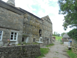
The onward path is generally easy to follow and you soon arrive at Ellerthwaite where you join a tarmac lane. Go left (east) along the lane which becomes a green lane after passing Thursgill. This is a beautiful section of the walk with the River Rawthey below on your right and pleasant views ahead. Hobdale Beck with its waterfalls adds interest as the green lane undulates towards Cautley.” Pure simplicity 🙂
I did the usual crossing of farmland in the wrong direction in search of the illusive gate to the hidden entrance to the unmistakable footpath to the required route, this included a small farmers field which had chickens, 2 emus, goats and some sheep in it, another which contained a lovely wooden bridge which was unfortunately inaccessible from one end, although the latter one, had a lovely old lady in the garden who pointed me in the direction of the official stile which led onto the required route, at last!


The last time I’d come close to this ‘neck of the woods’ was at least 20 years earlier when a couple of friends and myself did Wild Boar Fell, a nearby summit but not listed as been in the Howgills, So this one, a ten mile horseshoe with what’s believed to be the highest waterfall in England at its half way point, did, possess a wonderful and magnetic charm for yours truly. Anyway, having directed myself through the wonderful maze of Sedbergh and finally discovered my route to the required destination of the first half of my walk, which runs parallel to the River Rawthey to Cautley. A beautiful section of the walk which totally outweighed the frustration of its discovery.


This section of the walk is gentle and scenic, the waterfalls and streams which gently flow into it ensure the requirement of carrying extra water unnecessary, there’s a constant source to top up your water bottle, (once you’ve added the purification tablets), it was like the calm before the storm, in fact, it was too gentle, almost deceptive, but, a more superior way to spend a warm and clear Friday evening I couldn’t imagine.
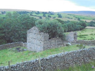
On arriving at Cautley Beck, everything changes, it’s as though a spiritual message descends upon you, it’s telling you how the easy part’s done, more effort required from this point onwards, the feeling of the isolation within the expanse of the wilderness takes its grip, there’s a whole new terrain awaiting you, one where you feel alone and without assistance, you are the master of your own destiny, there’s a sense of fresh and independent challenge, an inspirational feeling, it’s you and the fells, waterfalls, wild and deep, rocky crags and gulleys’, they’re unforgiving, you slip up and you’re in trouble, very serious trouble, with little chance of assistance, there lay the almost perverse attraction, the challenge.


Cautley Spout is the highest cascading waterfall in England, it’s a broken drop of waterfalls which tumbles a total 650 feet (198m). Gaping Gill on Ingleborough falls a greater distance but that descends into a pothole, and, Hardraw Force has a greater unbroken fall above ground, but Cautley Spout, from a viewpoint, really does take some beating as it proudly stands, dominating the head of a wild and bleak glacial valley, after it’s worked its way down through the high plateau above, The Calf. This fall is one of the few cascade falls in England; most are either tiered or plunge falls.
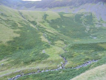
I always read the local information and description signs wherever I find them, and, the one at the base of the valley made particularly interesting reading, and not really one for the feint hearted, especially on an early evening, alone, with the intention of camping up there. It tells of the Iron Age footpath, which, archaeologists discovered and how it, without an understanding or explanation, simply terminates close to the waterfall base. What did these ancient people do there, was it ritual, spiritual, sacrificial, they don’t know, and, believe it or not, nor do I, but I do know it added a little eeriness to my expectations. As I continued up the valley I could feel the terrain closing in on me, entrapping me in a gargantuan funnel, the contours on the map told me the terrain was soon to become steeper, much steeper, and, I’d decided to ascend as much of it as I could prior to losing daylight. It was then, as I approached the waterfall itself, I could see horses, some sheep and two horses, I’d already seen their hoof prints in the mud, but, I never expected to see them alone, without riders or owners. They had no harnesses or anything, they were simply grazing with the sheep, who owned them, were they owned, I didn’t know. There are tales of wild horses roaming freely around the Howgills, it seems a difficult thing to believe on a tiny island where every square inch is owned by somebody or something bigger?
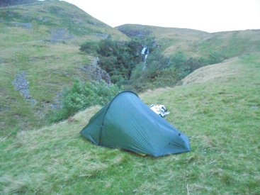
Because I’d eaten late, had little sleep and I knew the task involved of the sheer and steep ascent ahead of me, I decided to have breakfast when I’d climbed the awaiting and daunting terrain. Although my location was in the shadow of the surrounding hillsides, the glorious morning sun was working its way round to emblazen down on me, a more encouraging sign I couldn’t have wished for, that, and having the entire valley to myself, this was my Valhalla.
Having packed away all my kit, (I still need to reduce the weight of the backpack, even with what I consider the bare necessities, it still greatly weighs me down), I mentally prepared myself for what I knew to be the most physically demanding part of my route.


It’s either an age thing or a fitness thing or a combination of the two, but, ascending this magnificently steep waterfall, even on a well stepped and rocky footpath, it was as strenous and difficult as I’d expected, rewarding, but, very hard on these old legs. As I took one of too many rests to mention, the views were outstanding, Wild Boar Fell was visible in the distance, so too were other surrounding summits of which I knew nothing of, although, another early morning walker who I’d surprisingly met, told me he was heading for Yarlside, which, I discovered was close to where we were and it stood in the old neighbouring county of Westmorland, fantastic how I was bascially on the border of those traditional wonderful county borders of the West Riding and Westmorland.
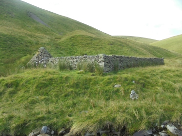
Having ascended the waterfall and upwardly continued, a route I beleived to be Force Ghyll Beck, I stopped for my boil in the bag breakfast, a hot coffee and another early morning break, all were welcoming. My exact location I didn’t know, if I maintained the route and track, following its easterly direction, I would join the Dales High Way footpath and the return route to Sedbergh, something I was sure of.
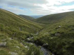
There it was, the Dales High Way footpath, the ghyll I’d previously followed, after the climb to the top of Cautley Spout, for that time of the day, after very little sleep, had severely drained me, but, its incredible after such a little navigational success, you can forget the aches and pains required to achieve it, and that’s exactly what happened. I was at the summit of the Howgills, with clear views, blue sky and a scenery the camera sometimes fails to complement.
The Lake District was clearly in view, the Yorkshire Dales were clearly in view, the surrounding Howgills were clearly in view, even the M6 motorway was clearly in view, Howgill summits I still knew nothing of, not even their names; something to be addressed at a later date.


Joining the Calf on the Dales High Way

Cairn on Calders
The descent was still another 5 miles to until I reached Sedbergh, the Saturday morning weather was bringing people out en masse, fell runners, walkers and even cyclists, unlike me, some really were ‘running up that hill’. What was in store for me, a wonderful high altitude footpath returning to my destination, what had I done, another amazing night on the fells with incredible scenery I’d once again, earned, and, rewards I’d never forget. The Howgills, the amazing, incredible, often ignored Howgills will be revisited and walked and studied in greater detail very soon, as for now, home James, and don’t spare the horses, even the wild, or, not so wild ones I’d seen earlier.


